Fall. Texas. Equal Earth.
Fall
Today is the first day of Fall with the equinox arriving at 8:05 p.m. Eastern. The equinox is an exact global event being the moment the sun crosses the celestial equator. I marvel that Hipparchus of Nicaea, the Greek astronomer, geographer, and mathematician made this discovery of the precession of the equinoxes – the gradual cyclic wobble of the Earth’s axis – around 130 BC.
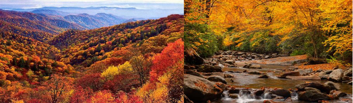
Goodbye summer! I knew that Fall was on its way by all the leaves falling (no pun intended). Almost every day, I am having to blow the leaves off my driveway. I live in east Tennessee, which is one of the most scenic places in the country. It is not as spectacular as parts of California, but as a friend of mine said when he moved from California to Knoxville: here the scenery is accessible. It is right out the front door not someplace on the horizon. The changing colors at my home and in the Smokies, along with deer hunting and college football, make this my favorite place to be in the whole wide world. BTW, the first week of deer hunting (bow) in Georgia was a total bust, marked by days in the mid-90s. The mornings were tolerable, but the oppressive heat later in the day made hunting completely out of the question. If I had stayed in Knoxville, I would have seen many more deer who enjoy relaxing near my carport and wandering through my backyard. It is also college football season, and games should not ever be played in 100+ degree weather. Maybe that is why my Ohio State Buckeyes lost to the utter embarrassment of us all, withering in the Texas heat. Speaking of which…
Why Texas?
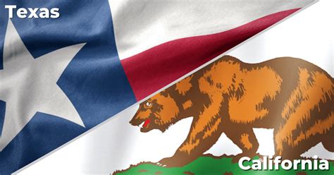
Texas has experienced stunning growth over the last 40 years or so. Its population has increased by 86 percent, to 31.7 million, since 1990, making it the second-most populous state in the country after California. Texas will overtake California as the most populous state by 2050. Its population growth has mostly been due to domestic migration from other parts of the U.S. (especially California), rather from outside the country. Apparently U-Hauls leaving California have basically become the new state symbol. If current voting trends continue – which is a huge assumption – the country would be affected by California losing many of its 53 congressional seats (46 Democrats) to Texas, which currently has 38 (24 Republicans).
Why are people leaving California to head to Texas? It certainly isn’t for Texas’ scenic beauty. California is one of the most spectacular states in the union. It is geographically diverse with a wonderful climate. Mountains, oceans, beaches. It is the nation’s largest agricultural producer and is resource rich. Texas – not so much. Its idea of scenic beauty is a Buc-ee’s on the horizon. Texas has crappy weather and unspectacular scenery. Okay, there may be some isolated spots that are not so bad, but they are rare and far between. But Texas’ mere existence as a growth leader demonstrates the power of less government, fewer regulations, and more freedom overcoming the desire to live amid breathtaking beauty. Can you imagine what the consequences would be if California’s stifling economic climate were suddenly transformed into Texas’? Here we clearly see the superiority of economics over aesthetics. To somewhat quote the Temptations: Beauty is only skin deep but a favorable tax code is forever.
This more points to the stupidity of California than to the genius of Texas. Sometimes winning is just showing up while the other guy trips over his own shoelaces. Me? Given the choice of California or Texas, I’d rather live in east Tennessee.
Equal Earth
A while back I wrote about the Mercator map was used by European ships’ captains because it allowed navigators to plot a straight-line course from point A to point B. That was awfully important in the days of rickety sailing ships navigating oceans especially when worried about sailing off the edge of the planet. But when the map translated a three-dimensional shape like the Earth into a two-dimensional projection like a map, it distorted size and distance as you got closer to the two poles. As a result, Greenland and Antarctica look huge. Greenland looks bigger than Africa, even though Africa is fourteen times larger. I made the conjecture that the wrong-sized map was part of the president’s obsession with Greenland. He said in 2021, “I love maps. And I always said: ‘Look at the size of this. It’s massive. That should be part of the United States.’” Nothing says diplomacy like coveting a piece of ice because it looked big on a map.
Oops.
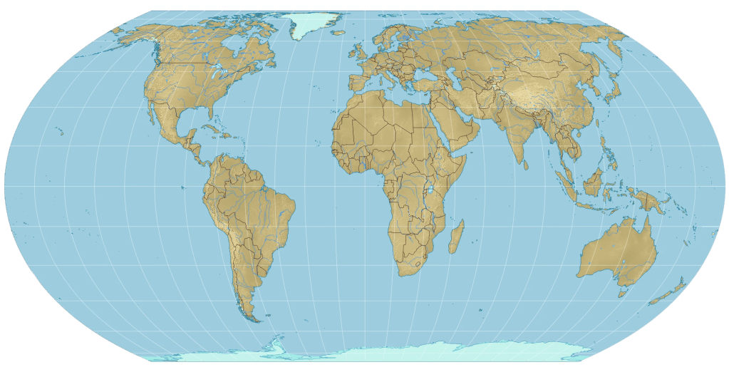
For centuries, the Africans were rightly miffed and wanted a more accurate picture of their continent. Well, the UN just adopted a map called the “Equal Earth projection,” created to show more accurately the sizes of the continents and intended to replace the old Mercator map in schools and on government websites. The map is a mathematical projection of the land and sea, without human-made borders. I had mentioned earlier an alternative – the Gall-Peters model – which was more accurate than Mercator but is not very esthetically pleasing, looking somewhat elongated, with some saying that it looks like clothes hanging out to dry (something that we can appreciate in here in East Tennessee). The Equal Earth map is more esthetically pleasing, but would not be very useful to navigate by for a 16th century captain of a sailing ship. Watch out for that edge! Somewhere, Columbus is refusing to update his GPS.
Oh, and the vote at the UN for adoption? It was 124-1, with only the US voting against. The US deputy UN representative, Yaryna Ferencevych – a good Irish name – said resolutions such as the “correct the map” effort were “barnacles on our work here.” Here is her statement:
“This resolution mocks the work and purpose of this institution. While this initiative is presented as an anodyne effort to update cartographic proportions, the United States clearly sees it cannot be separated from the much larger and more radical ideological project it belongs to – as its most vocal and committed proponents plainly and openly state.
Instead of focusing on genuine problems of international peace, prosperity, or good relations, this body is debating map projects from the 16th century, and their role in promoting reparations and “cognitive justice.” Resolutions like this and the ideological agenda they promote, are barnacles on our work here, and the reason this institution is losing its credibility. When the United Nations questions why it is losing legitimacy in the world, and is not taken seriously, time and again, we point to resolutions such as this.”
Huh? What does that mean? Did the US vote against it because the US appears smaller on this map than on the Mercator? Was it because Greenland is significantly smaller, belying Trump’s idea that it is “massive”? No. The statement is clear: the US voted against it solely because it is called the EqualEarth projection.


One of the most spectacular views I’ve ever seen was on the edge of San Francisco Bay, as fog overcomes the Golden Gate Bridge. But of course I would live in places far away with affordable homes. Wouldn’t see that often..
So- what does money allow me to see?..
Texas once had open plains , with an entire train of abandoned rail cars- and nothing around for miles. I’ll never forget my time with these dramatic Texas views, but wouldn’t travel to them everyday..
Wherever there are political egos, there will be politics:
..…”Henry Tanner’s 1823 map of Texas — then still part of Mexico — placed several rivers in positions that were off by enough to matter politically, particularly in the contested borderlands where American settlers were beginning to arrive. The error may not have been entirely innocent: certain boundary lines in Tanner’s version happened to favor American territorial claims.
First impressions of the 1823 plate, before any corrections, are a specific target for collectors who focus on the cartographic history of Texas annexation…”
This is fm Go2Tutors, which I unfortunately did not use their name correctly in the past.
LikeLike
Why Texas? A good friend – who is obviously an economist – sent me this excellent point.
It makes sense for governments to extract the benefits of a wonderful climate or wonderful scenery. They impose taxes to reduce the benefits of living there as opposed to, say, in remote parts of Kansas. The problem is that governments don’t stop there. Bigger taxes lead to bigger government, which then impose regulations to kneecap businesses.
LikeLike